Showing posts with label Victoria.. Show all posts

Thursday, November 22, 2007

FRIDAY'S HISTORY POST: OCEAN GROVE

This is one of the oldest buildings in Ocean Grove. This photograph taken in 1977.[Photograph from the Ocean Grove Album compiled by Bob Irving, courtesy of John Irving, Ocean Grove]


Map of where Ocean Grove is situated to the CBD.
I thought it apt to speak of the History surrounding the lovely place we go to so often to share in fun family times, and sucha relaxing place it is. Approximately 50 minutes drive away from our house you will find yourself entering this wonderful place. Just crossing the bridge from Barwon Heads to Ocean Grove is the most magical sight...second for myself to that of the sun setting into the Ocean (it would seem) when in W.A. at Freemantle.


So... Ocean Grove, it is named after a place in New Jersey, USA. During the 1870s the American Methodist church started a religious camp near New Jersey, it was such a successful idea they decided to spread there camps overseas. Soon they got together with the Victorian Methodists and set up a camp near Point Lonsdale ( a lovely place near Ocean Grove).
By 1882 the need arose for the church to acquire a large area of land so they could set up their "Australian Ocean Grove".

Ocean Grove State School in 1910 showing Mr. Hugh Clark and pupils. Hugh Clark taught at the school for almost 30 years and was Head Teacher from 1911 until 1925.
[Photograph from the Ocean Grove Album compiled by Bob Irving, courtesy of John Irving, Ocean Grove]
The place the Methodists chose was was situated on the east side of the mouth of the Barwon River overlooking Bass Strait. The town was later linked by a bridge to Barwon Heads on the other side of the river. Many street names take on the names of important people in the old Methodist community, while the local youth camp was run by the Methodist church from the 1920s up until 1996. Down Main Street Ocean Grove.
Now the largest town on the Bellarine Peninsula it has one of the largest shopping centres of any of the Bellarine towns only a few blocks from the beach making it popular with tourists and locals alike. There are groovy little cafes and some awesome clothes shops in Ocean Grove. Yet, the major draw card is, of course, the beach.

Friday, November 16, 2007

FRIDAYS HISTORY POST: Phar Lap: Australia's wonder horse

He triumphed during the Great Depression of the early 1930s, when a hero was most needed by the people of Australia.
He conquered the local racing scene—36 wins from his last 41 starts—and then won North America's richest race, the Agua Caliente Handicap, in 1932.
A fortnight later he went to the great equine heaven in the skies, struck down by a mystery illness that many suspected was the work of gangsters. The horse traveled with security guards to protect his safety. Gunshots were allegedly fired at the champion after one morning gallop.
For the history of Pharlap, click THIS LINK, complete with 1930's music, you will see the amazing horse that once stopped a nation.
His heart has been on display for many years in a museum. Why, I hear you ask? Because a normal horses' heart weights approximately 4 kilograms and Pharlap's was 6.2 kilograms. So amazing!
For a look at the film starring Pharlap, you can watch this clip also, accompanied again by wonderful music.

Thursday, November 01, 2007

FRIDAYS HISTORY LESSON: Collins Street Melbourne.

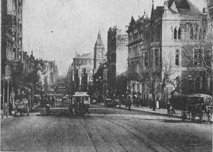
Collins Street in the early 1900's (courtesy of Rail Page)

Collins Street is a major street in the Melbourne central business district and runs approximately east to west.
It is notable as Melbourne's best known street, with some of the country's finest Victorian era buildings.
Known as The 'Paris end' of Collins Street, the Eastern end is a part of Marvellous Melbourne mythology. Although modern development has destroyed some of the European flavour of the top-end of Collins Street it still retains designer boutiques and cafes. The length of Collins Street between Elizabeth and King Streets has long been the financial heart of Melbourne and is home to banks and insurance companies.

One of the most breath taking buildings in Melbourne, if not on the outside, is probably 333 Collins Street Melbourne. The Atrium is one place you have got to see to believe. And, for your viewing pleasure, click HERE for a taste of it virtually. See...it does not disappoint.
Collins Street is named after Lieutenant-Governor David Collins who led a group of settlers in establishing a short-lived settlement at Sorrento on the Mornington Peninsula south of Melbourne in the early 1800s. He subsequently became the first governor of the colony of Van Diemens Land, later to be renamed Tasmania.
Festive time at The Block Arcade.
Around the turn of the century "doing the Block" became a pastime for shoppers at the Block Arcade area in the retail heart of the street between Elizabeth and Swanston Streets.
The Bank of New South Wales Melbourne office earned architect Joseph Reed a first prize in architecture. When the building was demolished in 1935, the facade was transferred to the University of Melbourne to become the Commerce building, (now administration for the Faculty of Architecture, Building and Planning)
During the 1950s and 1960s, the street became subject to extensive redevelopment and many historic buildings were demolished by Whelan the Wrecker, despite the efforts of the National Trust and the "Save Collins Street" group. While some examples of boom style architecture survive, the grandest examples were lost to the wrecker's ball. Of the major losses, the most significant were the large Victorian buildings including the Federal Coffee Palace, Colonial Mutual Life building, Robb's buildings, Queen Victoria Buildings, City of Melbourne Bank, Scott's Hotel, Melbourne Mansions and APA building.
Between 2003-2005, Collins Street was extended west beyond Spencer Street, and currently ends in plastic barriers and a T intersection with Stadium Drive. It is expected to extend further west in the future, as part of the new Docklands redevelopment. This will create an intersection between Bourke Street and Collins Streets, two of Melbourne's most important streets.
One of our top tourist attractions is the Rialto Towers pictured above. Standing at 251 m (824 ft), this allows visitors to have a birds eye view of Melbourne, our Port Phillip Bay and, if it is a clear day, you can see as far as The Dandenong Ranges.
There are also many gorgeous churches along the street, and if you take some time out to walk along and really look at each building you may find some treasures there..even if you have lived here for ages, sometimes things can go unnoticed. Oh, and if your feet get weary, don't fret, you can just hop on board a tram!

Thursday, October 25, 2007

Friday's History Lesson: Station Pier, Port Melbourne...

Station Pier Today

Station Pier in the year 1910. Immigrants arriving in Melbourne.

History of Station Pier : Originally called Railway Pier, it was officially opened on 12 September 1854 and the 150th anniversary was celebrated in September 2004.
The pier played a pivotal role in Victorians’ lives from the time it was opened, particularly for the arrival of gold seekers and settlers throughout the mid to late 1800s.
In 1861, the original pier was extended, to more than 661 metres (2171 feet). Eventually, the original pier could not accommodate the increasingly large and more powerful steamships of the early twentieth century so it was realigned, extended further and renamed Station Pier.
The pier is heritage listed and the gatehouse at the entrance is of significant heritage and cultural importance.


The Gatehouse, Station Pier.
Comings and goings: In August 1899, the first contingent of troops headed for the Boer War in South Africa left from Station Pier. In October 1914, 16 ships left Port Melbourne carrying troops, horses and supplies as part of Australia’s contingent for the Great War (World War I). Station Pier was also the place of return for the military hospital ships.

HMS IMPLACABLE, FEB 1946

The 1940s saw many troops embark for the Middle East, Britain and Singapore for World War II service.
Station Pier is intrinsically linked to Melbourne’s rich multicultural society with an average 61,000 overseas passengers arriving on an annual basis in Port Melbourne between 1949 and 1966. For many post-World War II immigrants Station Pier symbolises where their new life began.

HMAS Doomba, 1940. This ship was a training vessel aswell as a minesweeper.

Today, the pier has more than 500,000 local, interstate and overseas visitors, including migrant family and friends' reunions.

There is so much romance involved in the history of shipping, in the history of what went on, and what goes on today beside the waters at Station Pier. You really have to be there to acknowledge the fact. Sit, have a coffee, enjoy some seafood from some of the fine eateries just down from the Pier and observe....you won't be disappointed!

Thursday, October 18, 2007

FRIDAYS HISTORY LESSON: MILDURA.... Lock 11


The Lock was designed and built in the 1920s and 1930s to provide pools for irrigation and allow for boats to move along the Murray River year-round regardless of water levels. Today the locks allow paddleboats, houseboats, cruise and recreational craft to move up and down the river. (There is a strange looking handle bar like device in the middle of the grass there..do you see it? This was the device that was made redundant that would have been seen in operation up until the 1970's which used to operate the Lock.)

Mildura Weir and Lock 11 are separated by an island, and are popular places for pelicans and locals who fish for carp, perch, cod and bream. Walking from one side of the river, just over the little metal walk bridge and stepping onto the other side takes you from Victoria to New South Wales. Actually, if you were to step one foot in the water you would have one foot in NSW and the other in Victoria.

Once an important trading route, the Murray River was busy with boats carrying supplies to and carting wool from the region's stations and homesteads. Today visitors can board an historic paddle steamer or paddleboat in the river towns of Mildura and Wentworth to experience this traditional form of travel and find out more about riverboat history. It truly is spectacular and romanic!!


To see the Lock in opertation just clink on my photobucket link HERE. It sure is amazing!!!


Friday, October 05, 2007

FRIDAY'S HISTORY POST: SAILOR'S FALLS.


Today my cousin met up with me at Sailor's Falls. This is where we exchanged kids...you know, Tomas went to her place up the bush and her little girl who is my Nicholas' age came to stay and entertain my other three kiddies.
This place is just such a hidden treasure. If you were not truly searching for it you would all but drive right by it.
Situated about 50 minutes drive out of Melbourne, towards the lovely Mineral Springs area of Dayelsford is Sailor's Falls. 5 kilometres shy of Dayelsford to be exact. Sailor' Falls was originally known as Tunnel Falls(More about that later).
The story behind the name of this magical place is that there was once a group of sailors who jumped ship in the 1850's. They had come to Australia to seek their fortune in the Gold Rush. They discovered this lovely creek an tried their fortune at mining the stream. What they did discover was that this creek ran into a 15metre drop water fall, and that the area was indeed rich in minerals.
Sodium Bicarbonate waters can be found in the Northern Spring Outlet.
In the 1850's, Miners tunneled in beneath the waterfalls for the rich content of the various rock formations. Sub-basaltic deep lead alluvial sediments to be exact. The tunnel and trestle supports were still present below the falls up until the 1920's.

Now, the place i a lovely picnic place and a loos top. You can walk right down to the falls and there are many tracks to go for long all day walks from the picnic area itself.
See, the magic is in the eyes of the beholder...and the smell..... naturally glorious!

Thursday, September 20, 2007

FRIDAY HISTORY POST: Dromkeen.

Dromkeen is a graceful nineteenth-century homestead that has been classified by the National Trust, and accredited through Museums Australia - Victoria. It is situated in the small township of Riddells Creek, outside Melbourne in Victoria. It is the home of the Australian Children's Literature Collection, a unique collection of original artwork, manuscripts and other pre-publication material from Australian children's books.


DROMKEEN HISTORY:
At the turn of the century, Dromkeen was the home of Judge Arthur Chomley, who presided over the County and Supreme Courts of Victoria. His country estate, built in 1889, was named ‘Dromkeen’ to maintain a connection with his mother’s family home at Tipperary in Ireland.
In 1973, Dromkeen was purchased by Joyce and Court Oldmeadow. They used the homestead as a private residence and as a bulk store and freight centre for their educational bookshop. Before long their love and interest in children’s literature led to the establishment of the Dromkeen Collection, and Joyce and Court's house became a home for Australian children’s literature.


Joyce and Court Oldmeadow dedicated their lives to preserving for public display the original artwork and manuscripts of Australian children’s literature, many of which had hitherto been lost or destroyed. Passionate in their desire to inspire children with the creative processes of children’s books in the making, they also wished to preserve this unique part of Australia’s heritage as a ‘living’ collection for everyone to enjoy.
Court Oldmeadow died in 1977, and in 1978 Scholastic Australia took over the responsibility of maintaining the Collection.
Joyce Oldmeadow continued to develop Dromkeen. In 1982, she inaugurated the Dromkeen Medal, which is awarded annually to an Australian citizen whose work has significantly contributed to the appreciation and development of children's literature.
To guarantee a permanent home for the Collection, Scholastic Australia purchased the homestead in 1985.
Joyce Oldmeadow died in 2001. Daughter Kaye Keck continues her parents' legacy as the present Director of Dromkeen.
Scholastic's involvement fulfils Joyce and Court Oldmeadow's dream that the Dromkeen Children's Literature Collection should be available for children and adults alike as a constant source of enjoyment and inspiration.


Possum Magic
Author: Mem Fox

The Dromkeen Collection is a priceless exhibition of original artwork and manuscripts from our continuing heritage of Australian children's literature. Dromkeen also boasts fine gardens with Australian and English plants and trees.


The Man from Ironbark
Author: A B ('Banjo') Paterson

Children's literature comes alive through bronze garden sculptures, and the gazebo provides a welcome resting place following a walk around the Heritage Trail. You can picnic in the extensive gardens, or go visit some of the neighbouring wineries after you leave Dromkeen.


I remember fondly my first trip to Dromkeen as a child with my school. An Australian Author read one of her books to us and we sat in the garden near those sculptures o listen to her. The illustrator was also there. It is a magical place. And so, my love of books began here.. Mr Lizard and Gumnut Baby
Author/Illustrator: May Gibbs


My favourite thing of al here is the writing on the plaque accompanying the very top image hre on this post. It reads "Visitors will be captivated by characters from Australian Children’s stories including Koala Lou, Wombat Divine, Shy the Platypus and the inspiring dragon representing the children’s Dromkeen Dragons club."
Do visit and do touch!

Thursday, September 06, 2007

FRIDAY HISTORY POST: Hurstbridge..

30 kilometres north-east of Melbourne you will find the quaint town on Hurstbridge. Regular readers will recall my family outing to this lovely town aboard the steam train a few weeks ago for the Wattle Festival.


Railway in Hurstbridge.

The extension of the railway to Hurstbridge in 1912 was primarily to service the local fruit growing area, but it was also responsible for the early growth of the Hurstbridge Township.
Most of the early growth was centred along the Main Street, on land subdivided by Frances and Bill Gray and occurred between 1912 and the mid 1920s.
Several of the older buildings, shops and houses along the main road are good examples of the architectural styles of that time.

The majority of the Hurstbridge township area was not subdivided into residential blocks until after the Second World War (1945-46). Electricity came on in 1957.
The coming of the railway changed many things and gradually produced a change in the population and the work patterns and opportunities for the residents.
It was then possible to reside in the pleasant bushland setting of Hurstbridge and work in the city, much as the people do today. Getting there by train takes 50 minutes on the Melbourne-Hurstbridge line.


Settlement of the area.


The Wurundjeri people were the traditional owners of the country that extended from where Melbourne now stands to Mt Macedon and Healesville. The Wurundjeri spoke the Woiworung language and, with other tribal groups, was part of the Kulin nation.
The Wurundjeri Willam clan lived around this local area for at least 40,000 years in small family groups.
Their descendants still live in the Melbourne area, with a strong community centred around Healesville, in the Yarra Valley.
In 1841 Cornelius Sharp Haley took up, from the Government, the 'Allwood' run. Haley ran cattle and horses and built a slab hut close to where the present Allwood House stands.
Henry Hurst, a surveyor, came to Victoria, from England in 1852.
In 1859 he moved to 'Allwood to manage 160 acres for Cornelius Haley. In about 1865 Henry's parents Frances and Robert Hurst and some of their seven children joined Henry at the Allwood run.
It was about this time that Henry built the first log bridge across the Diamond Creek. This was soon known as 'Hurst's Bridge'.
On the 4th of October 1866 Henry was fatally wounded by a bushranger, Robert Bourke. Bourke was captured and was tied to a wheel of a wagon under a tree (now known as Bourke's Tree) until Sergeant Fawcett and Trooper Hall from Queenstown arrived. Bourke was tried, found guilty of the murder of Henry Hurst and was later hanged.
Come on, visit this lovely area.

Browse the local antique shops, including the Old Tin Shed
Follow the Hurstbridge Heritage trail around the town and learn about its early pioneer beginnings. Collect a brochure from a local Visitor Information Centre
View kangaroos in the wild on the town outskirts
Stop at a local café for good coffee or enjoy vegetarian and organic fare at Chocolate Lily.
You may care to visit the Yarra Valley wineries (five of which are within 10 minutes drive of the town centre). Interstate and international visitors, quite often make Hurstbridge their base and go into the city by train on the Hurstbridge Line, or take day trips to the Yarra Valley or the Dandenong Ranges.

Oh, and every weekend there is live music played out in the main street during the month of October too :)


Thursday, August 30, 2007

FRIDAY'S HISTORY LESSON:The City of Geelong.

Geelong is the second largest city in the state of Victoria, Australia and is the largest regional centre in the state. It is a port city with an urban population of approximately 161,000 people. Also it is one of the largest provincial cities in Australia. Geelong is located on Corio Bay, 75 kilometres south-west of the state's capital, Melbourne.
The city is a gateway to many renowned tourist attractions, namely the scenic Great Ocean Road, the Shipwreck Coast and the Bellarine Peninsula.
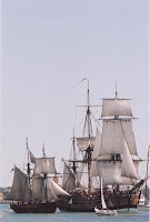
The explorers Hamilton Hume and William Hovell. They reached Corio Bay - the area of Port Phillip Bay that Geelong now fronts - on 16 December 1824, and it was at this time they reported that the Aborigines called the area Corayo, the bay being called Jillong (Hence the places now known as Cario and Geelong). Hume and Hovell had been contracted to travel overland from Sydney to Port Phillip, and having achieved this they stayed the night and begun their return journey the following day. William Buckley, an escaped convict from the Sullivan Bay settlement, lived among the Wautharong people for 32 years in the Bellarine Peninsula. Sighting of an old ship on Cario Bay.

1840 saw the first issue of The Geelong Advertisor Newspaper which still runs print today. 1850's saw the Goldrush increase population in Geelong from 8,000 to approximately 22,000. The port access a clear advantage.

The town of Geelong officially became a city on 8 December 1910. Electric trams began operation in 1912, travelling along Pakington St, Geelong West and the city centre until their demise in 1956.
Electric Car TRam Geelong 1912.


Between 1922 and 1925 Geelong's industrial growth began: three woollen mills, fertilizer plants and the Ford Motor Company's vehicle plant at Norlane. The Corio whiskey distillery (1928) and the Geelong Advertiser's radio station 3GL (now K-Rock) (1930) were opened.

Now Geelong is a popular Summer vacation spot and has everything you would wish for as a couple or as a family. Theme parks, the waters edge, carnivals, restaurants, museums and, if you don't fancy driving to Geelong there is a V-Line train service that can get you there from Melbourne. Remember our family train trip to Geelong recently?

Fond memories of wading in the water at Eastern Beach and eating ice cream and riding the old carousel ( manufactured in 1892) are mine to keep and yours to make!

Thursday, July 19, 2007

FRIDAY'S HISTORY LESSON: BENDIGO PART 2...

Sacred Heart Cathedral is the principle Church of the Diocese of Sandhurst and the home Church of the Cathedral Parish serving the people of central and north west parts of the city of Bendigo and many visitors to the church and the city. It is a lovely piece of architecture to be sure.


The Cathedral was built in two stages. The first, comprising the nave and side aisles, was opened in September 1901. There was then a long interval until 1954 when work recommenced. The second stage was finally completed in 1977.
The Sacred Heart Cathedral is one of the largest churches in Australia and a major tourist attraction for the city of Bendigo. Its initial construction and final completion were made possible through the remarkable achievements of Rev. Dr. Henry Backhaus, the first priest on the Bendigo goldfields. In addition to his priestly role, he was very active in civic affairs and skilled in financial matters. Between his arrival in 1852 and his death thirty years later, he accumulated considerable property. This was left for the benefit of the church and enabled the Cathedral, among other things, to be built.
At the end of the Talking Tram tour we visited the Central Deborah Gold Mine. It is a well known tourist attraction that offers the unique experience of exploring a real gold mine on one of the underground mine tours. Whether it's touring the surface of the mine with its treasure trove of vintage mining machinery, gold panning for riches or taking one of the spectacular underground mine tours, visitors will never forget a stop at Central Deborah.
Sixty metres underground , don a hard hat and miners lamp and walk in the footsteps of miners who discovered almost one tonne of the world's most precious metal on the Mine Experience Tour. Here are Tomas and Nicholas with their special gear on for their tour with their dad.
All attentive, the boys really had a great time and they learned so much and had heaps to talk about once they all surfaced.
An image of the skips used to bring the rock to surface from beneath in the mine. There was a small cinema that the girls and I, along with my grandad, went into whilst the boys were on their adventure. We got to sit and relax and watch the history of the mine and the people who brought about the Gold Rush that occurred in Bendigo and its neighbouring regions.

Boy, am I glad it was the boys that were beneath the earth there...they did say it was warm, but I doubt it was cosy.

Bendigo is a really nice city to visit. Every building in the central part of Bendigo has some part in its history. The talking tram tour soon points this out, and it is so affordable to go on it... you ought to have a go when you get there!

Friday, July 13, 2007

FRIDAY'S HISTORY LESSON: BENDIGO, PART 1.


This morning we drove to Woodend Train Station to catch the V/Line Train to Bendigo. Not before we travelled up top of Mt Macedon to have a look if there was any snow. Nope, the weather was not quite cool enough. But, we were driving up so high that we were inside the white clouds. The gardens of the houses on the Mount are spectacular. Buds are beginning to appear..a sign of Spring to come.


Woodend Station...Platform 1. The opening of the railway line linking Melbourne to Woodend took place in 1861.


Melbourne bound.


Atop the footbridge looking Bendigo bound.


Our train is approaching.


We arrive at Bendigo and walk down to take the talking tram tour. The tram runs along the main thoroughfare of Bendigo. As it goes along a narration plays for the passengers about the history of Bendigo.


Monument to those men that have fallen who served their country and came from Bendigo and its surrounds.


Rosalind Park Bendigo. The glass conservatorium you see pictured was erected in 1897. It is home to many a flower show. Namely the Chrysanthemum Association display on an annual basis. It is empty at the moment yet still lovely to view.


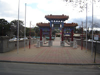
This is the gateway to the History of Chinese settlement in Bendigo. Back when the Chinese first came to Australia chasing the Gold Rush that had hit this region, the people got off the ships in Adelaide in South Australia and walked all the way to Bendigo. They have a remarkable place in the history of Bendigo's mining, and are still to this day a large part of the town's Culture. Beyond this entrance is the Golden Dragon Museum. It houses the famous Sun Loog Dragon, the longest imperial dragon in the World. During the Easter Fair in Bendigo, Sun Loog makes an its annual appearance. This is an image of the Bendigo Steam Tram. C. 1892. When these were in use, they used alot of water and were, for the most part, very noisy for passengers. It is said that the noise alarmed many people taking the tram, whether it was to work in the mines, to go to the station or to go to church on a Sunday. Needless to say, they were phased out.


There are up to 40 tram cars in the depot being worked on or waiting to be repaired back to their original condition. Being that it takes time and of course money, this is something that will take a good deal of years to accomplish. One of the tram cars they had there was in a very bad state. It had been found out back of an old ladie's place, thought to have been used as a storage shed or chook shed.


A picture of Sarah with her Great Grandad. He was very excited to see us all up in Bendigo.


An image of the Gas Works in Bendigo.It was built in 1859 and was in operation for over 100 years. It is the largest coal gas producing plant with horizontal retorts left in Australia. Bendigo had gas lighting as early as 1861. These gas works closed in 1973 due to the arrival of natural gas.


Due to the influx of people to this area during the peak of the Goldrush there was a problem. People had machines set up all along the Bendigo Creek, as many as 1200 at one time. These sorted the rock and dirt out and hopefully showed some glistening of gold. The by product of this, being that water was needed and a point of drainage also needed, was lurky muddy water. In order to combat this, the council of the time lined the canal with concrete, rocks and wooden sides. Which can be seen in the image above. Right now, the water level is low due to the drought. Yes, there has been some rain in this area, but not enough to fill any reservoir or this canal


Anyhow, there is much more to this tour, and much more to Bendigo..stay tuned for next week's Part 2 of Bendigo History.